12/09/2009, 1200 nautical miles NNE Brazil
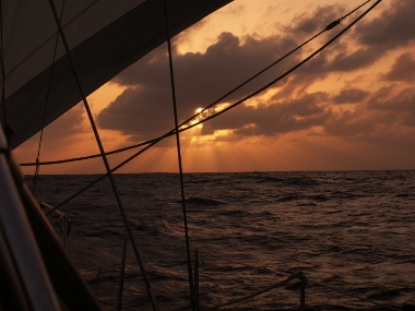
Sunset somewhere on the Atlantic Ocean (Hans)
Clapping
boom and flapping genoa indicate that the wind has veered and
decreased. the only sign of human life outside our vessel is an AIS
indication of the vessel TANCRED underway to Cotonou Benin. Her closest
approach to QRIII: 16.4 NM; outside visual range.
Where are we? Somewhere on the Atlantic Ocean. Our board computer tells
us that we have still 10 - 11 days sailing ahead of us, provided that we can
maintain our speed. On the other hand: we are almost at a point of
equidistance between Africa and South America. We will reach that point
today or tomorrow. Brazil stretches out to the East: from longitude 34°
50' W we will be sailing north of Brazil, the Guyana's, and Venezuela.
Also this moment is only one or two days ahead of us.
I woke up early on a waterbed of 4.5 km thick. My shift runs from 02 -
06h, likely with an extension because with this low wind we may set the
gennaker at dawn. That will speed us up by 1 - 2 knots like it did
yesterday. That was a quiet day: the swell had passed and a stable
(over the day) breeze of 16 - 18 kt from the NE pushed us towards
Barbados. With the gennaker set we managed to maintain a speed of 7 - 8
kt, well above the 6.1 kt that Ulric initially computed and that would
bring us in 18 days from Tenerife to the Caribbean. That is: without
the unscheduled stop at Cape Verde Archipelago.
What do you do in such a day? Watching the clouds, the waves, flying
fish, some seabirds (in the middle of the ocean!). Make some food, work
a bit on the computer, drink coffee, drink more coffee. Life on this boat
hasn't bored me a second yet!
So now and then I take my sextant to practice in celestial navigation.
On our leg, predominantly from east to west, it is even possible to do
navigation without tables of star/sun/moon position: just a few data
are enough to have once a day a rough estimate of our position: measure
the highest point of the sun above the horizon at noon, and realize
that it is almost winter and the sun is as good as above the tropic of
capricorn.
Then our latitude at noon of
measurement is about: 90 - 23.6 - angle sun-horizon. The -23.6 is the
latitude of the tropic of capricorn. The longitude is also not so
difficult, although not so accurate: at Santa Cruz de Tenerife it was noon
(highest position of the sun) at 13h. Santa Cruz is at 16° W.
Measurement of the time of highest position of the sun yields our rough
longitude as: (T - 13)*15 + 16, with 13 the Tenerife noon time and 16
the Tenerife longitude. T is the measured ship's time of the Sun's
highest point and the factor 15 is the conversion of 24 hours to 360
degrees.
All you need is some logical thinking, a good sextant, a watch, and
sunny weather around noon.
I use tables and some software on board. I
can do the job more accurate as described above. Still, even if our
electronics fail we won't get
lost at sea. We will arrive at Barbados without wandering around too
much.
| \/ | \/ |